If you are a Mindanao-based hiker or a traveler seeking a trail that perfectly balances physical grit with ethereal beauty, Mt. Dinor in Sta. Cruz, Davao del Sur, is your 2026 must-visit destination.
While Mt. Apo stands as the “Grandfather” of Philippine mountains nearby, Mt. Dinor offers a distinct, intimate experience that seasoned trekkers—the Manakaay ug Bukid—know is incomparable. From the crystal-clear, refreshing waters of the Pilan River to the mysterious mossy forest at its summit, this mountain is a masterclass in biodiversity and indigenous heritage.
In this comprehensive guide, we’ll dive into the logistics, the costs, the two main trail options, and the essential amenities that make Mt. Dinor a premier choice for both dayhikes and overnight stays.
Mt. Dinor At A Glance: Technical Profile
Knowing the numbers helps you pack the right gear and set the right pace.
| Feature | Details |
| Location | Brgy. Sinoron, Sta. Cruz, Davao del Sur |
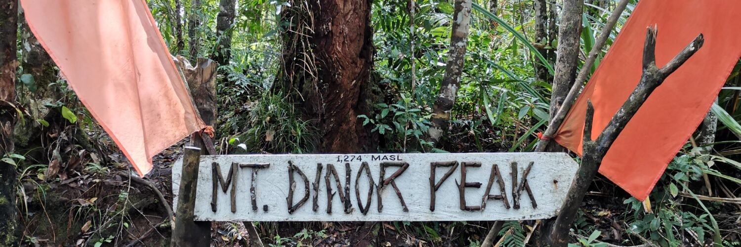
| Elevation | 1,274 Meters Above Sea Level (MASL) |
| Difficulty | 4/9 (Standard) to 6/9 (Waterfall Route) |
| Trail Options | 9km (Direct) or 13km (Waterfall Alternate Route) |
| Parking | Secured parking near Sinoron Gymnasium |
| Campsite Perks | Stores, Toilets, and Potable Water |
| Highlight | Mossy Forest, Pilan River, and Almasiga Trees |
Getting There: Logistics for the Modern Hiker
For Commuters
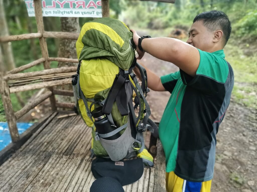
From Davao City, head to the Ecoland Bus Terminal. Board any bus bound for Digos or General Santos. Ask the conductor to drop you off at “Kanto Sinoron” in Sta. Cruz. From there, a habal-habal (motorcycle) can take you directly to the Sinoron Barangay Gymnasium.
For Private Vehicles (Cars & Motorcycles)
One of the best upgrades to the Mt. Dinor experience is the dedicated parking area located right near the Sinoron Gymnasium.
- Security: If you plan on staying overnight at the campsite, you can leave your car or motorcycle here with peace of mind.
- Capacity: The area can accommodate multiple SUVs and a large fleet of motorcycles, making it ideal for organized club rides or family adventure trips.
Choosing Your Adventure: The Two Faces of Mt. Dinor
Mt. Dinor is unique because it offers two distinct ways to reach the top. Depending on your fitness level and what you want to see, you have a choice to make at the jump-off.
1. The Standard Trail (9km – The Direct Path)
This is the classic route. It takes you through rolling hills, coconut plantations, and the famous 7 water stations. It is shorter but features several steep “assault” sections that will test your cardio.
2. The Waterfall Alternate Route (13km – The Scenic Path)
For those who live by the mantra “the longer the better,” the 13km Waterfall Route is a revelation.
- The Experience: This trail bypasses the usual path in favor of a deeper trek into the jungle. It takes you past hidden waterfalls where you can hear the roar of the water echoing through the canopy long before you see them.
- Challenge Level: Expect more river crossings and technical terrain. It eventually converges with the main trail as you head toward the peak, but the extra 4 kilometers are filled with lush, untouched scenery that the standard trail misses.
The Mt. Dinor Campsite: Comfort in the Clouds
Gone are the days of “roughing it” in total isolation. The Mt. Dinor campsite (Station 7) has evolved into one of the most hiker-friendly spots in Davao del Sur.
- The Stores: Forgot your coffee or ran out of biscuits? There are small sari-sari stores right at the campsite. On weekends, you can often find locals selling hot native coffee, boiled eggs, and even instant noodles. It’s a great way to support the local community while lightening your pack.
- Sanitation: In a major win for mountain tourism, there are toilets available at the campsite area. This makes the overnight experience much more comfortable, especially for female hikers and beginners.
- Water Source: A reliable spring is located nearby, providing some of the coldest, cleanest mountain water you’ll ever taste.
The Summit: A Velvet Sanctuary
As you push past the campsite toward the 1,274 MASL peak, the temperature drops significantly. You enter the Mossy Forest.
Unlike the open grasslands of other nearby peaks, Mt. Dinor’s summit is a shaded, mystical world. Every branch is covered in thick, green moss. Epiphytes and rare orchids hang from the Almasiga trees (Agathis philippinensis). On a clear day, you might catch glimpses of the surrounding Davao del Sur mountain ranges through the breaks in the trees, but the real star here is the forest itself.
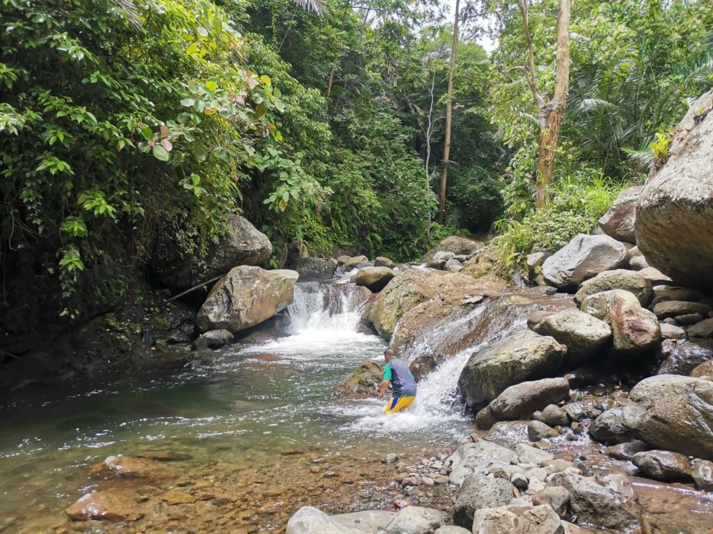
Post-Climb Bliss: Relaxing at Pilan River
No Manakaay trek to Mt. Dinor is complete without a stop at the Pilan River on the way down. This is the ultimate “nature’s spa.”
Swimming and Cooling Down
The river features crystal-clear, turquoise waters and several deep pools perfect for swimming. The cold water is scientifically great for muscle recovery after a long descent. Don’t miss the “Mini Asik-Asik”—a curtain of water falling from the rocks that provides a natural power-shower for tired shoulders.
Where to Have Lunch?
After your swim, hunger will definitely kick in.
- River-side Picnic: Many hikers choose to have their “binalot” (packed lunch) right on the large flat boulders by the river.
- Local Carinderias: Near the jump-off and the Sinoron Gym, there are several local eateries (carinderias) serving fresh native chicken tinola or grilled fish. Sharing a hot meal here is the perfect way to cap off the adventure before heading back to the city.
2026 Budget Breakdown (Estimated)
- Environmental/Registration Fee: ₱50
- Guide Fee (Dayhike): ₱800 – ₱1,000 (Group of 5)
- Guide Fee (Overnight): ₱1,500 – ₱2,000
- Parking Fee: ₱50 (Motor) / ₱100 (Car) per night
- Porter Fee: ₱500 – ₱800 (Optional)
Expert Tips for the Manakaay
- Waterproof Everything: The mossy forest is damp even when it isn’t raining. Use dry bags for your electronics.
- Limatik Awareness: In the 13km waterfall route, you might encounter limatik (leeches). Wear long socks and bring alcohol or a calamansi to easily remove them.
- Respect the Culture: This is Bagobo-Tagabawa ancestral land. Your guides are the stewards of this mountain. Listen to their stories and respect their rules.
- Leave No Trace (LNT): Pack out all your trash. The stores at the campsite are a convenience, but don’t leave your wrappers behind.
Mt. Dinor Summary & Key Takeaways
Mt. Dinor is a rare gem that offers a “full-package” adventure. You get the physical challenge of a 13km trek, the beauty of a mossy summit, the comfort of a well-equipped campsite, and the pure relaxation of the Pilan River.
Whether you are parking your car at the gym for an overnight stay or hitting the waterfall trail for a grueling dayhike, Mt. Dinor reminds us why we love the mountains of Mindanao.
Are you ready to hike Mt. Dinor this weekend? Don’t forget to tag manakaayugbukid.com in your summit photos!
Everything You Need to Know Before Hiking Mt. Dinor
1. Is Mt. Dinor beginner-friendly?
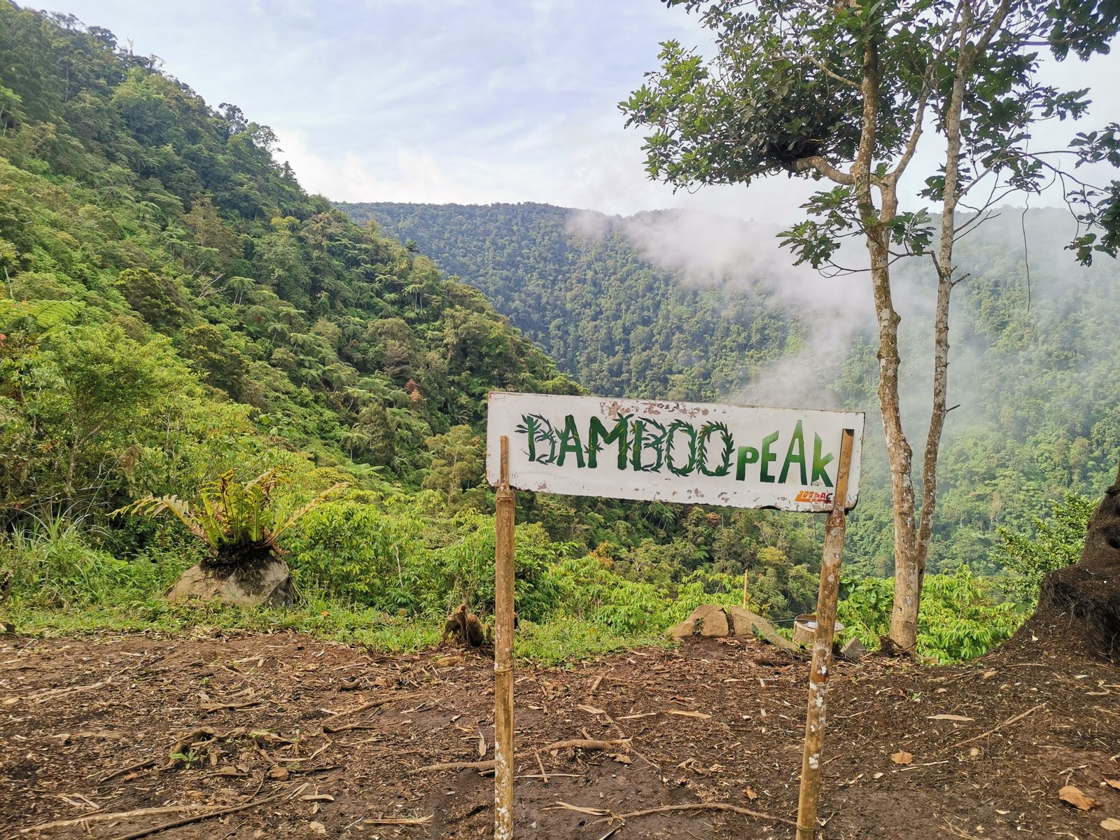
While it is classified as a “minor” climb (1,274 MASL), the trail is moderately difficult due to steep inclines and potentially muddy conditions. Beginners with a good level of fitness can manage it, but we recommend taking the 9km Standard Trail rather than the 13km waterfall route for your first visit. If you’re not quite ready for the steep inclines of Mt. Dinor, we highly recommend starting with our ultimate beginner’s hiking guide to Bamboo Peak (Buntod Ta Laya).
2. Can I leave my car or motorcycle at the jump-off overnight?
Yes. There is a secure parking area located near the Sinoron Gymnasium. Many hikers who stay overnight at the campsite park their vehicles here. It is generally safe and monitored by local community members.
3. Are there toilets and stores at the Mt. Dinor campsite?
Yes, the Station 7 campsite is well-equipped. It features toilets for hikers and small sari-sari stores that sell basic snacks and native coffee, particularly on weekends.
4. What is the 13km alternate route?
The 13km route is a longer, scenic alternative that includes a visit to hidden waterfalls before heading to the campsite and peak. This route is more technically demanding and is recommended for hikers who want a deeper “jungle” experience and more river crossings.
5. Do I need a guide for Mt. Dinor?
Yes. Local guides are mandatory for safety and to respect the Bagobo-Tagabawa ancestral domain. You can secure a guide at the Sinoron Barangay Gymnasium upon registration.
6. Where is the best place to eat after the hike?
The Pilan River area is the best place for a post-hike picnic. You can also find local carinderias near the Sinoron Gym that serve traditional Filipino dishes, ideal for a heavy lunch after descending.